If you like hikings, you already like Bosnia and Sarajevo. This is a post and guide including a .gpx track for day hike near Sarajevo. The mountain I am going to recommend to you is called “Trebević”. It’s very near Sarajevo and if you are in Sarajevo and reading this, if you move your head up you probably can see it. The important thing is it’s reachable without a car and you can spend the whole day there.
If you’re considering a hike up Trebević Mountain, let me share some tips and my personal experience to help you plan your adventure. Trebević is the closest mountain to Sarajevo, making it an easily accessible spot for nature lovers. Known as a popular day trip destination, especially on weekends, don’t be surprised if you find yourself among many fellow hikers. The trail is moderately challenging, but even if you’re a beginner, it’s manageable as long as you wear sturdy hiking shoes.
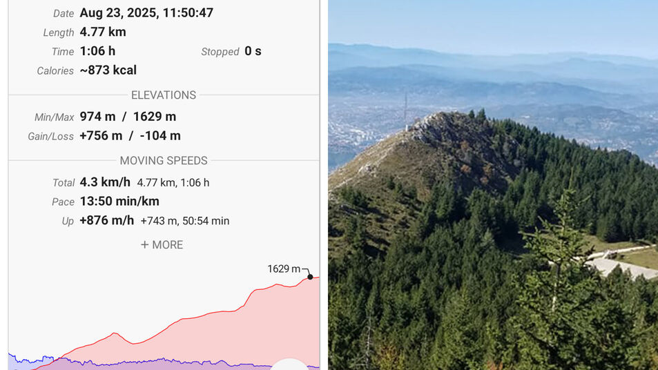
This hike begins at an elevation of 974 meters (Near Pino Nature, Prvi Šumar – Starting point) and climbs steadily to the summit at 1,629 meters. Although the route measures only 4.77 kilometers one way, don’t let the relatively short distance fool you. The trail gains an impressive 756 meters of elevation while descending just 104 meters , making it a consistently uphill challenge from start to finish.
One of the standout features of this hike is its sustained gradient. Instead of alternating between steep climbs and long flat sections, the trail continuously gains elevation, allowing hikers to make steady progress toward the summit. The elevation profile includes only one short downhill section near the beginning before resuming its climb, with the steepest stretches appearing during the final third of the route. As you approach the top, the terrain becomes more exposed and rocky, rewarding your effort with increasingly spectacular panoramic views.
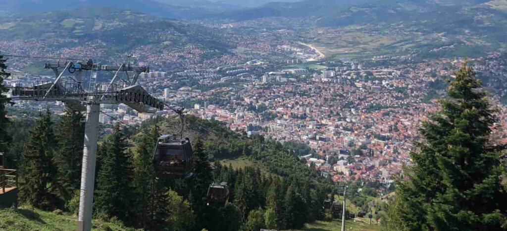
There are two ways to go to Trebevic: by walking from Old City and by Cable Car to the starting point. I recommend taking a Cable Car to a certain point so you can save some time and energy and enjoy relaxing more.
Are there landmines? No, there are no landmines. It’s probably the most visited mountain in the whole of Bosnia, but I would still advise to stay on the marked path.
Is there drinking water? Yes, near Dobre Vode. It’s approximately in the middle of the trek, so if you think about how much water to carry, have it in mind.
How much time? It’s written on marked route multiple times its around 3,5 hrs, but depending of your condition it can be less or more. Pleaes have on mind that there is rocky area on the top which can cause to spend more time.
Sarajevo Views from Trebević Mountain
Trebević is one of Sarajevo’s most beloved mountains. At the base, near the parking areas and the “Pino Nature Hotel,” you’ll likely encounter crowds, especially families with children, as many visitors prefer to drive or take the cable car up. This is particularly common during summer or when the city below is covered in fog.
Two Ways to Start Your Hike
By Foot: Walk to the starting point near the “Pino Nature Hotel.” This route takes you through the suburban neighborhoods of Sarajevo, mostly on paved roads.By Cable Car: Take the Sarajevo Cable Car, which drops you close to the trailhead near “Pino Nature Hotel.” (If you are not sure, ask someone where is it, or follow .gpx I uploaded) We opted for the cable car, and I’d recommend it for a more scenic and quicker start. The cable car ticket costs 30 KM (€15) for a round trip. To avoid crowds, aim to ride early in the morning. The ride lasts about 15 minutes, offering stunning views of Sarajevo. From the cable car station, you can follow a forest path or the road to the trailhead. The trails are well-marked, but if you’re unsure, feel free to ask locals. People are friendly and speak good English.
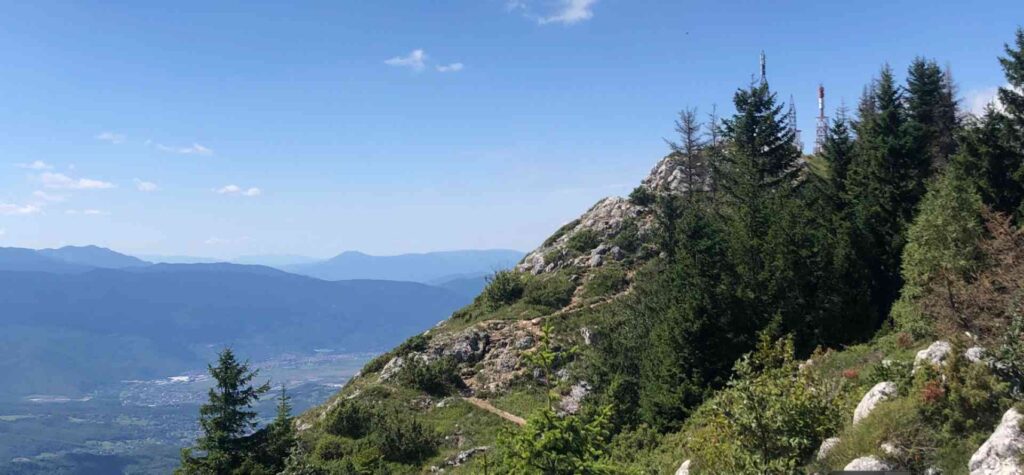
The Trek to Trebević Peak
From the starting point, the hike to Trebević peak takes about 3.5 hours. Along the way, you’ll find a water source roughly halfway up the trail, so bring a water bottle just in case. A cycling path also runs parallel to the hiking trail, adding to the lively atmosphere. Once you reach the peak, you’ll be rewarded with breathtaking panoramic views. From here, you can see Bosnia’s famous mountains like Bjelašnica, Igman, Jahorina, and Romanija, as well as nearby towns like Pale. Also there is huge tower on the peak. Peak is belonging to Repulika Srpska entity.
Jure Franko Stop
Close to the peak (it’s 45m from peak), there is “Jure Franko” mountain cabin, a charming spot run. It’s an excellent place to unwind with affordable drinks and snacks. If you wish to extend your adventure, you can even spend the night here. The cabin offers incredible views of Sarajevo, especially at sunset. It’s very popular stop for hikers, mostly going down. Also, many people are comming only to Jure Franko, and not going to Peak.
The Descent
The way back takes about 3.5 hours, similar to the hike up. If you plan to return via the cable car, make sure to check its schedule to avoid missing the last ride down. Cable Car is working untill 21:00 during the summer, and untill 19:00 during winter, please please check it again with staff.
.GPX Download
There is .gpx file that you can download and use on your phone. Screenshot is showed on beggining of the post. Please have in mind that this trek is going to peak, not back, but I beleive it will be very helpfull.
DOWNLOAD FREE .GPX